

Tuesday 22 ta' July 2025
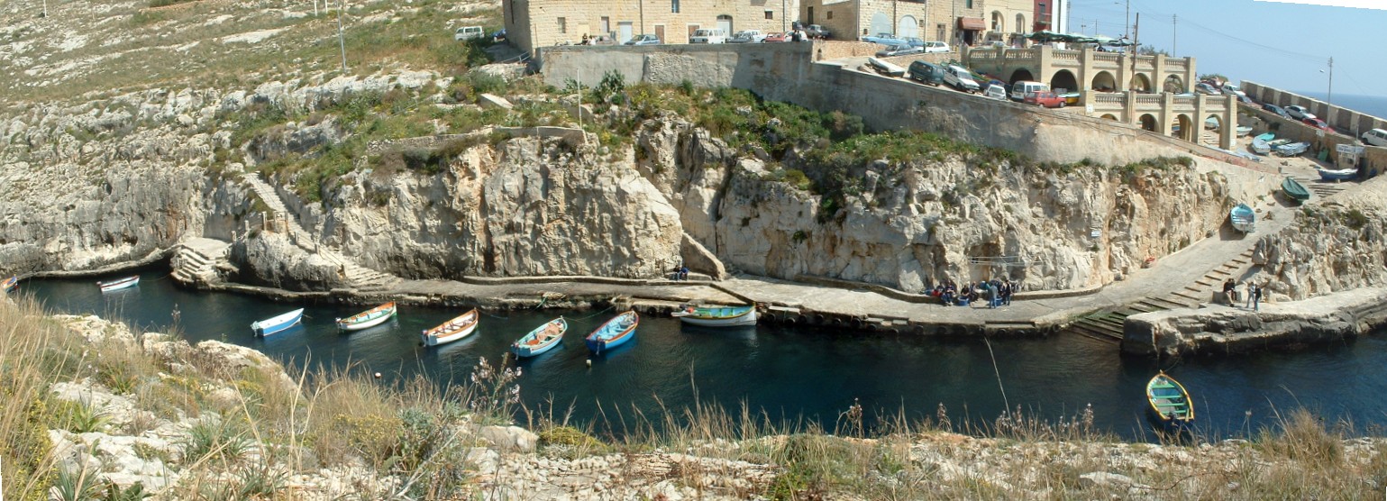
The Wied iz-Zurrieq hamlet and small fishing port has long been the source of a dispute between the Qrendi and Zurrieq population over its ownership, a dispute that goes back to the other century.
However, since the year 1910, this fishing hamlet was, under the archiepiscopal decree, placed within the spiritual jurisdiction of the Qrendi parochial boundary. In turn and with the creation of the Maltese local councils, Wied iz-Zurrieq and the Blue Grotto were placed within the Qrendi Local Council confines, through the Local Council Act of 1993
Although named Wied iz-Zurrieq, the valley itself sees its origin at a locality known as Wied Hoxt, a valley which reaches as far back as the panoramic road connecting the Blue Grotto (il-Hnejja) to the Hagar Qim temples.From the time and where charts were not readily availably, property and fields in the Maltese countryside were identified through names given locally. Like wise Wied iz-Zurrieq has numerous identification names given to particular spots within this very same valley.
Proceeding seawards from the inner left side of the valley we come to il-Majlia, possibly a corruption of the Italian word, Maglio (costume), a shallow water small inlet formerly frequented only by women and children, that were allowed to cool down after a strenuous walk and climb down to the waters.
An inch cape rock (Submerged rock) marks the "boundary" permissible for non-swimmers, called il-Hmara (The donkey), offering hours of fun to young boys and girls, under the watchful eyes of their mothers,
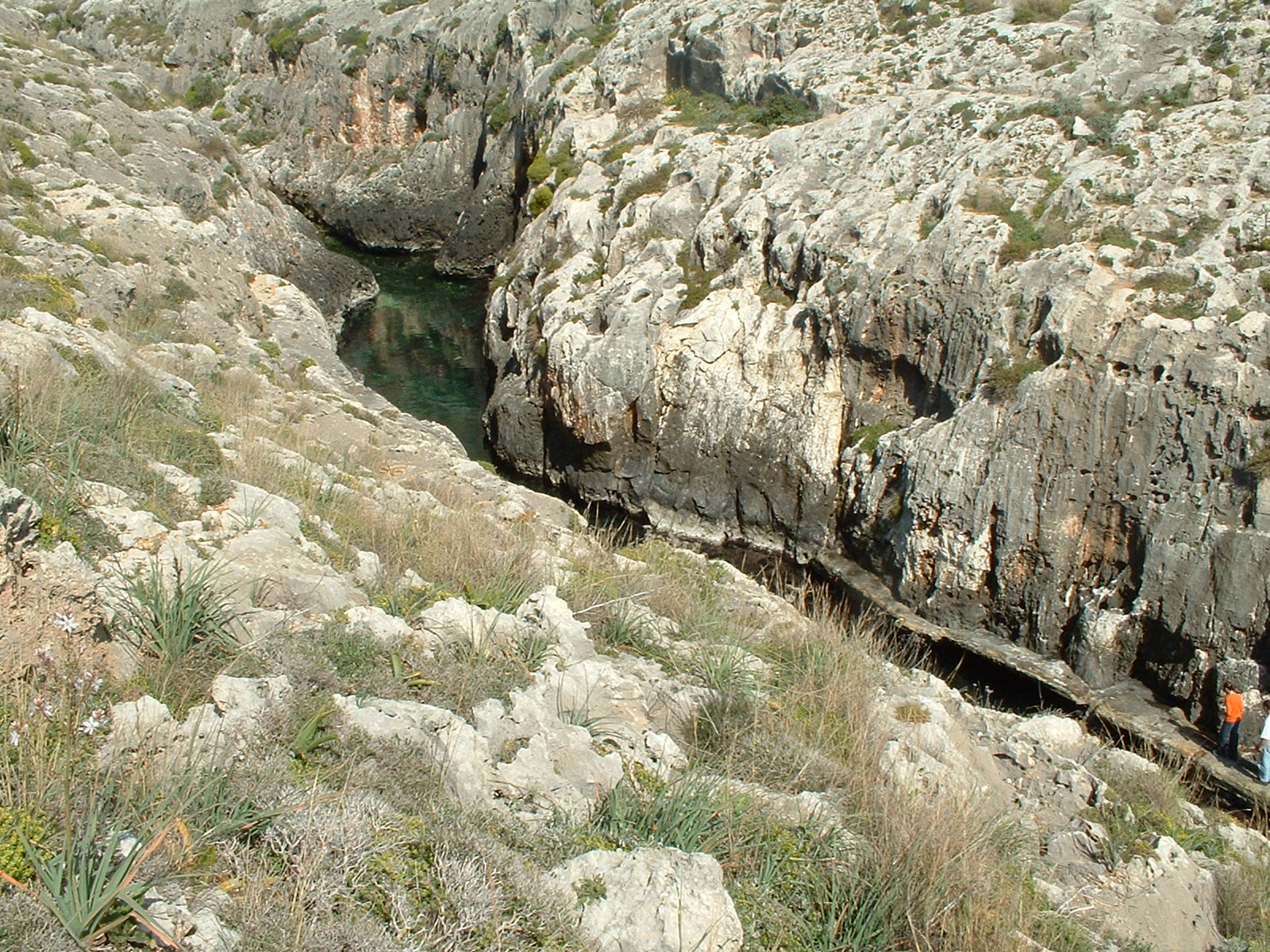
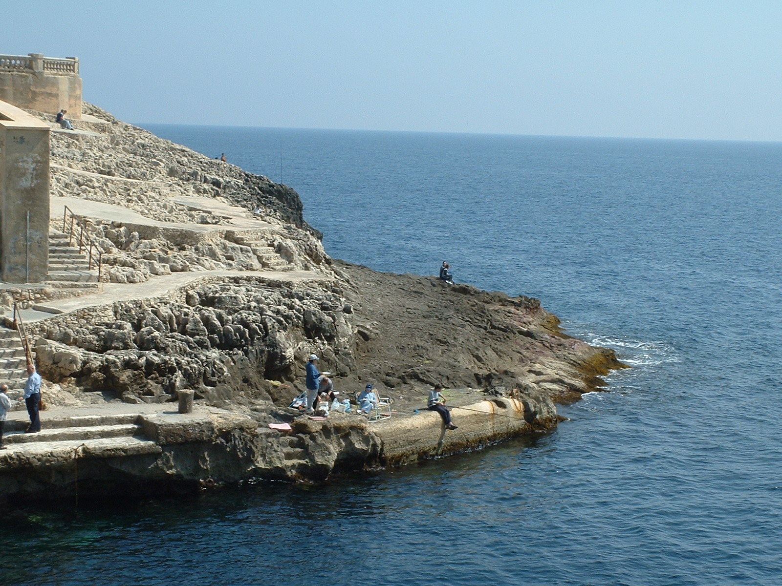
The need for a small landing and berthing place at the inner part of the valley saw the excavation of small steps allowing easier and independent access down to the water's edge. The bench like steps adopted the name of Id-Dikkina, possibly derived from an old Arabic word, "Dokkana" meaning benches, offers the ideal place to families wanting some peace and away from the boats coming and going out of the valley.
A small waterline concrete path sees a connection path from Id-Dikkina to the only slipway within the valley and the main hub of activity, Lis-Skall (The Slipway), between which is a small area was formerly known as Il-Kappara (the caper shrub). A location where high diving was practiced by adventurous youth requiring to make a three meter clearing from this ten meter high rock platform. A practice, discontinued in the early sixties with the quay's extension beneath.
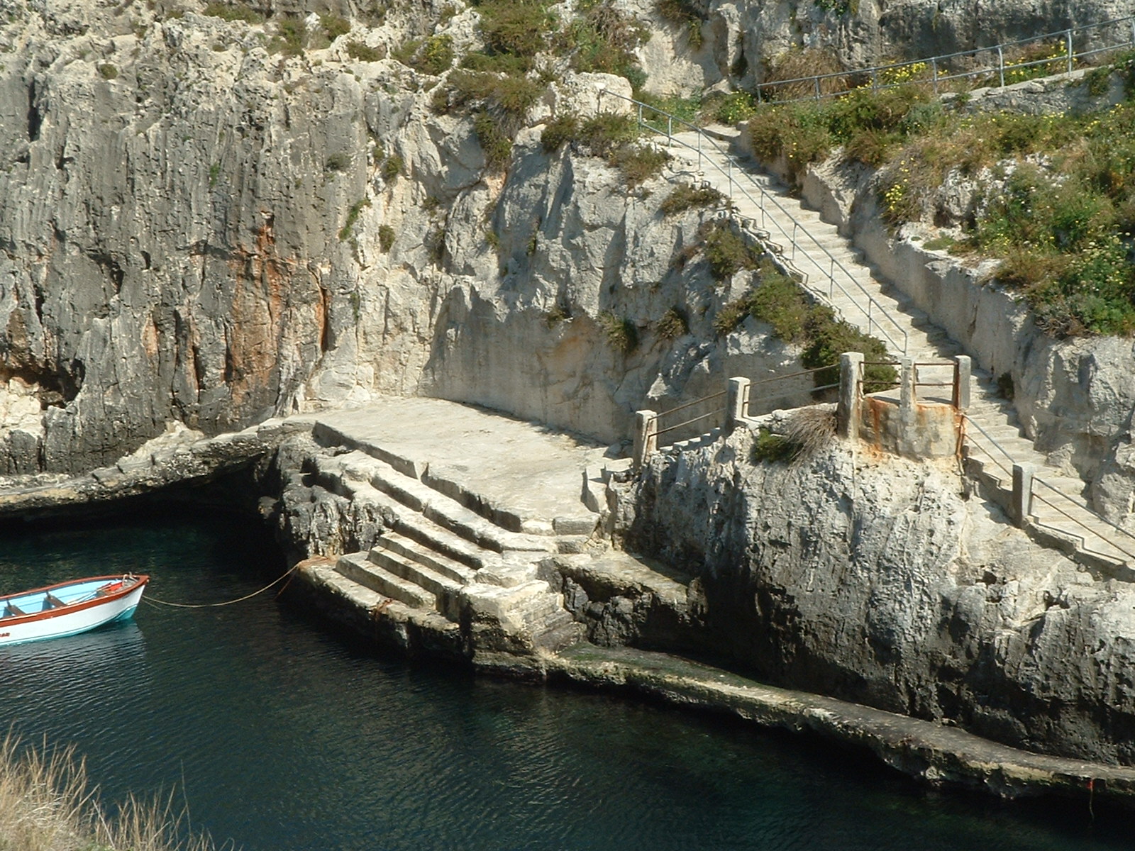
The Skall has been the most frequented part of the Wied iz-Zurrieq valley due to it's protection from rough seas in the leeway side to a higher quay know as Il-Ponta (The Point), a location favorable with the local swimmers and not "too adventurous" rock divers.
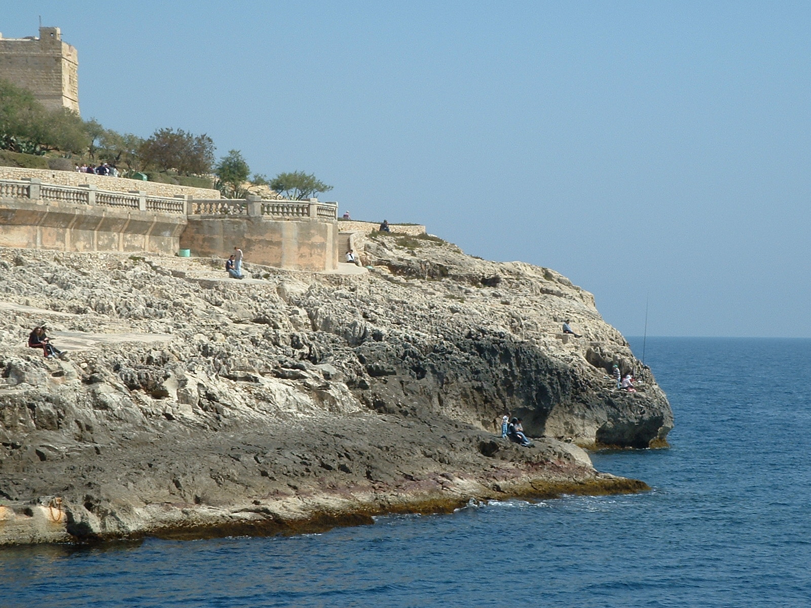
From "Il-Ponta", a pathway leads to another stairway at the mouth and the deeper end of the valley, Il-Moll ta' Xandru (Alexander's Quay). A quay purposely built to allow the berthing of the first motorized fishing launch, that as owned by a renowned fisherman, Xandru D'Amato.
From this area one can experience the topography of Maltese Lower Coralline limestone formation. A landing or rather "man made" sun deck, full of holes and sharp rock formation littered with small holes and rock openings and natural salt pans. To no surprise, this area is more commonly known as "Il-Ponot" (The points).
Around the corner to Il-Ponot, mid way to the Blue Grotto, one can find a most interesting Rock feature better known as Gebla ticcaqlaq (The moving rock). This huge rock of over fifteen meters in height, tightly wedged into the cliff face, is believed to move and make loud noises during violent wintry storms.
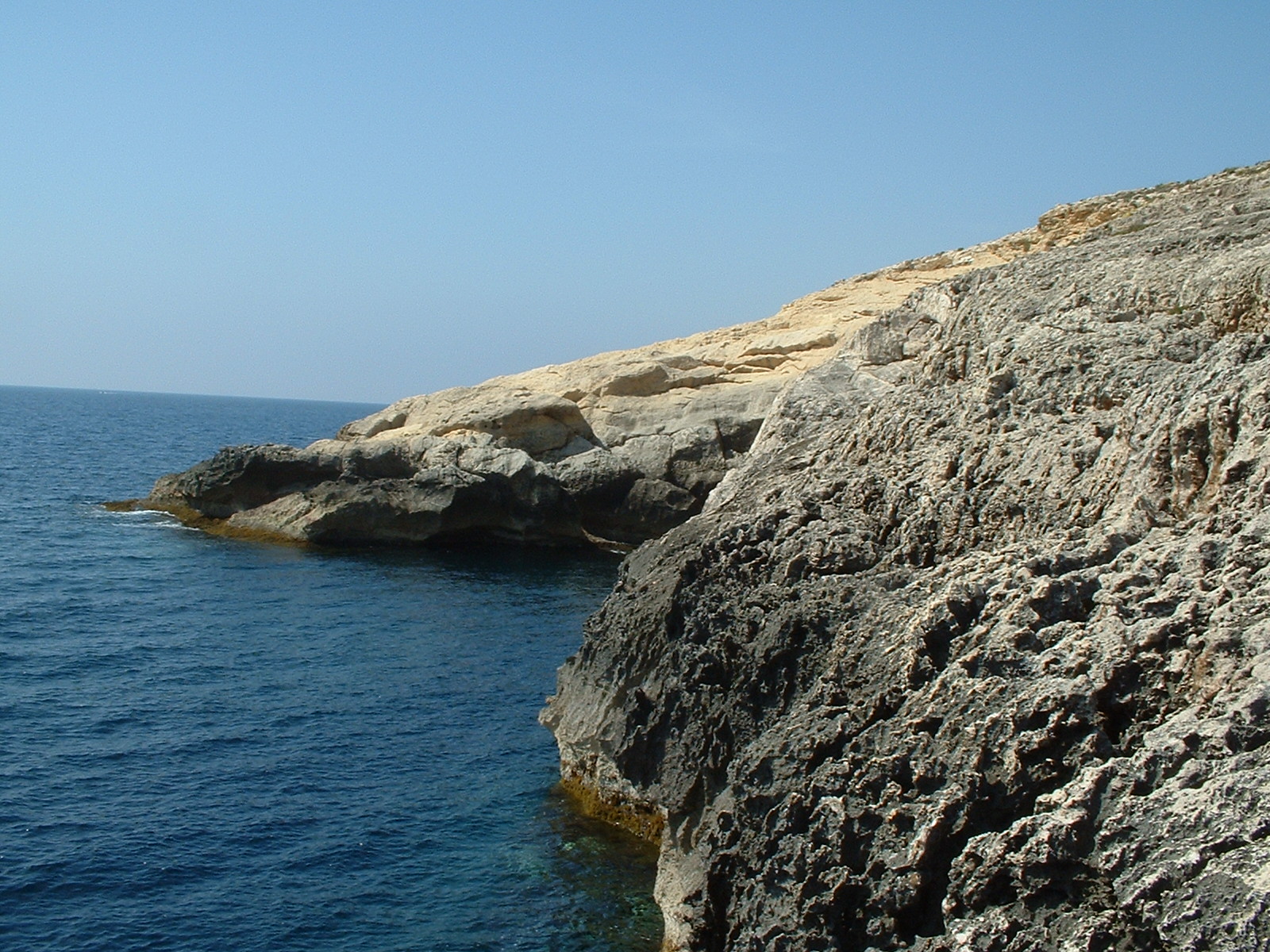
Crossing the mouth of the bay a small cape is know as Ras Masu (Masu's Cape) or as it has recently been called Dahlet il-Parpri (The Duck's landing place), is also surrounded by the same sharp rock formation from across the bay, equally known as Il-Ponot (The points)
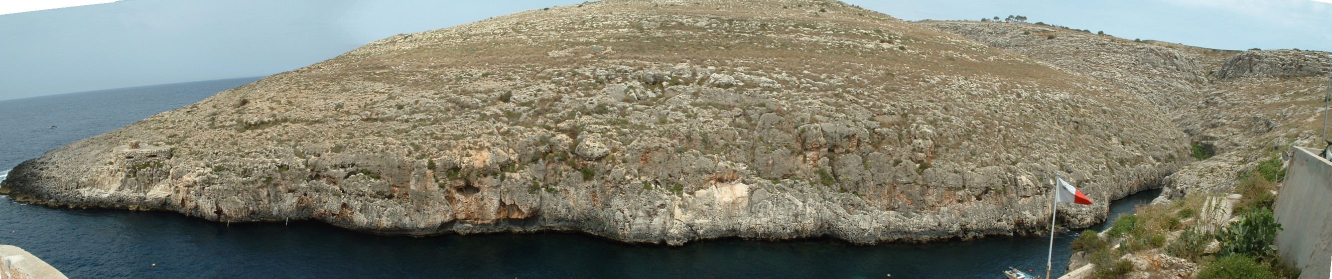
From Il-Ponot, moving inshore one finds Il-Kamra it-Tonda (The round room), a former WW II pillbox, extremely popular with those youths wishing to experience the adrenaline in one's body caused through "run and jump" diving from height and having to clear a four meter landing beneath. An area, which has over the years, experienced numerous accidents through the non-clearance of the underlying rocks when diving off this dangerous hazard.
Inshore from Il-Kamra it-Tonda, one comes across a small cave-like opening, some six to ten meters above sea level, known as L-Ghar. Above this opening, the most popular high diving spot in the whole valley can be found, a site where one's efforts are witnessed and admired by the locals and tourists alike.
Another split level inshore diving site popular with the less adventurous and the ladies alike, is known as Iz-Zurzieqa (The Slide). A place where the height of ones dive can be calibrated to ones desire and skill. From this location to the inner valley, no other location is frequented due to the vertical and high cliff walls that offer no stimulation due to their harder access by the valley's bathers.
Since earlier times, Wied iz-Zurrieq together with Ghar Lapsi, have provided the best fishing harbour on Malta's South West coast. A place of immense hardship, but the nearest fishing port to the Qrendi and Zurrieq villages, a role played till the mid sixty's when the former Maltese fishing boats, the Luzzu and Kajjik were replaced by the Wied iz-Zurrieq Fregatina, a sturdy four meter wooden boat capable of transporting eight passengers and two coxswains opting to visit the Blue Grotto.
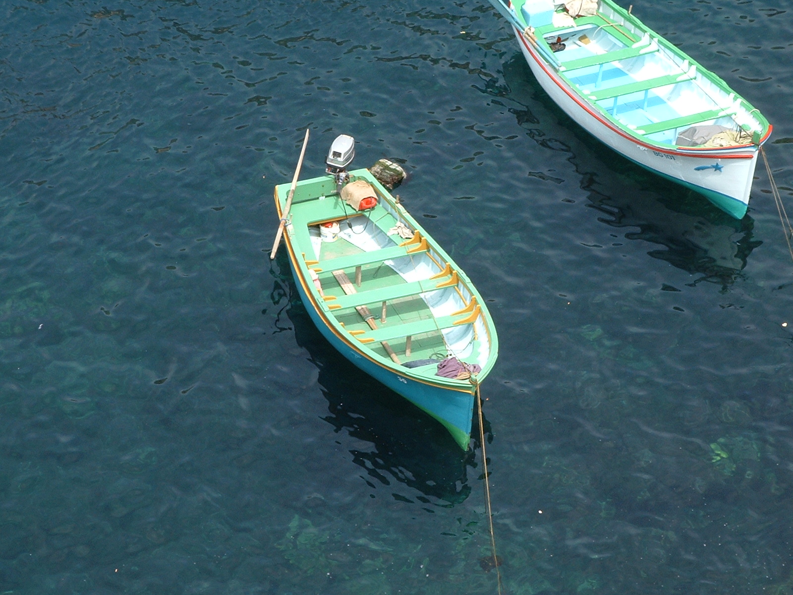
Sadly the wooden Wied iz-Zurrieq Fregatina has since been replaced by a modern fiberglass prototype that requires lesser yearly maintenance and upkeep.
But Wied iz-Zurrieq is not just known solely as the ferry landing for the Blue Grotto visitors and the Location of the wreck of the Un el-Farroud so frequented by visiting divers, but also for its depth of water that varies from six meters at the valley's inlet to twenty three meters at its mouth.
Water visibility in access of twenty to thirty meter is most common in this underwater diver's paradise. A locality of immense beauty, both above and below the water surface.