

Tuesday 27 ta' May 2025

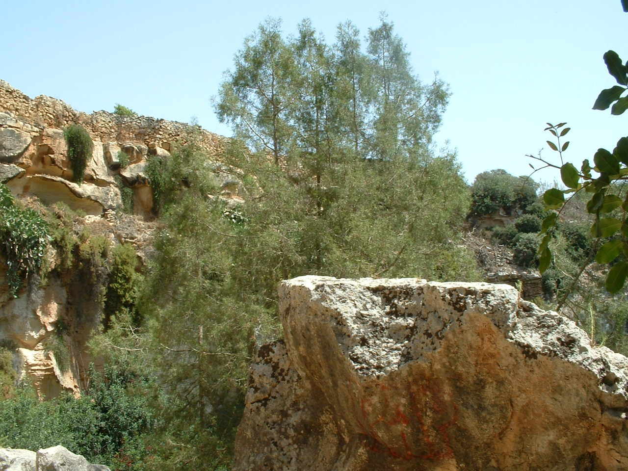
Adjacent to the chapel of San Mattew, situated on the road connecting the village to Wied iz-Zurrieq, one comes across another interesting feature quite unique to the village of Qrendi. An interesting "quarry like" feature formed by a depression in the land, filled with Maltese trees and shrubs is quite breath taking and truly impressive. A wild sanctuary for carob trees, where the Maltese National tree, the Gharghar (Sandarac Gum) can be found growing wild. A place where Laurel trees grow in harmony with bamboo cane and Ivy. A place where Pomegranate trees grow in great abundance.
This name Maqluba (Over turned) is the name given to two similar depressions found within the Qrendi boundaries and within two miles of each other, both having totally different characteristics from one another.
Behind the Maqluba magnificent views comes a legend equally as impressive. Handed down through the generations, we learn of bad people living together in a small village or hamlet (Hal-Lew). Almighty God warned the village, through a good woman living close by and often referred to as a nun, against their bad ways.
Unheeding these warnings, God decreed that the land swallow the village sparing none except the good woman. In turn, angels were dispatched to dispose of the "bad village" by dumping it at sea. Legend thus tells of the formation of the island of Filfla situated some five kilometers to the South West of the fishing port of Wied iz-Zurrieq.
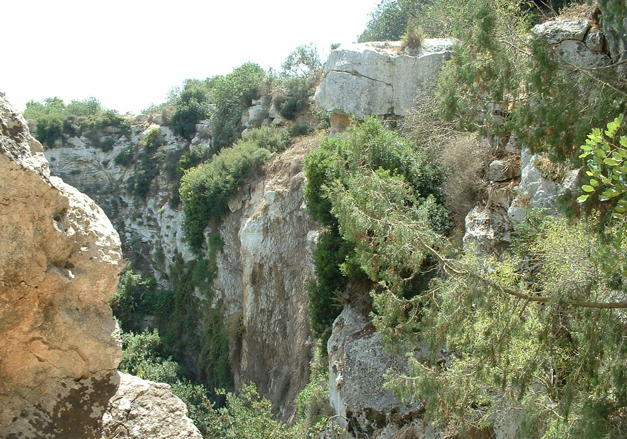
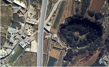
On the 23rd November 1343, Malta experienced one of it most severe winter storms in history, a tempest or possibly an earthquake. It was at this time that the formation of this phenomenon came about. The Maqluba is a natural conical depression formed by the collapse of the underlying limestone strata, commonly known in geological terms as a doline. It is a sinkhole collecting rainwater from as far as a five kilometer radius, water much needed to cater to the needs of its thick vegetation whilst allowing its access supply to penetrate the rock formation helping to maintain our underground water supplies.
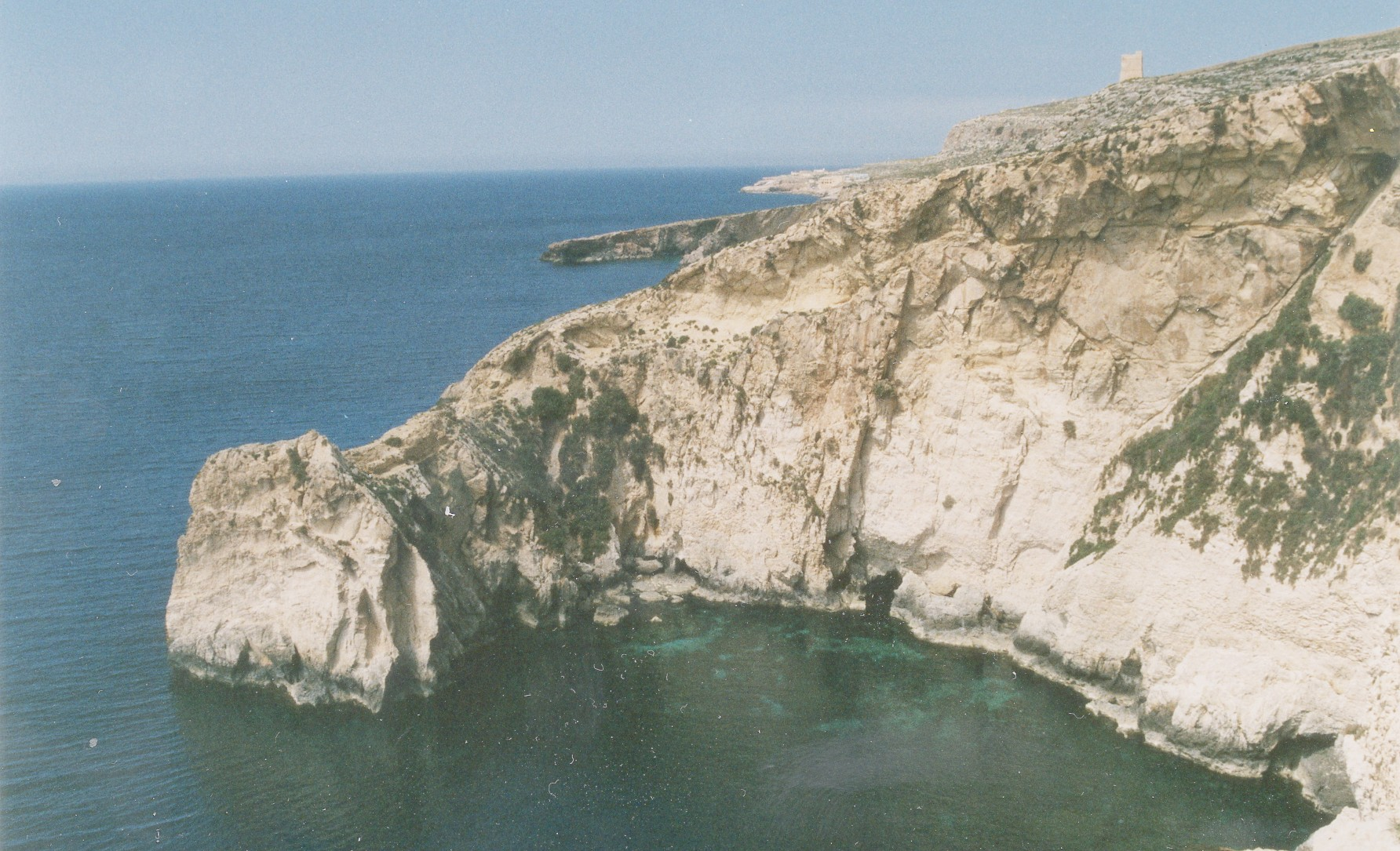
An equally spectacular site found on the coastline, just a stone throw away to the west of Wied iz-Zurrieq is known locally as Maqluba l-bahar or Ghar ix-Xaghra.
This "horse shoe" formation, formed through the sea erosion of the cliff face and open to the clear blue Mediterranean Sea, boasts of a magnificent marine environment. A place where the Damselfish dances within the colorful fauna. Underwater caves, tunnels and caverns mystified by the sun's ray with water visibilities in access of thirty meters. Tranquility and serenity interrupted only by the musical sound of the gentle waves splashing against lose rock formation.