

Friday 20 ta' June 2025

Situated on the brow of the hill to the west of the road leading from Hagar Qim to the Mnajdra temples, one comes across another interesting site unique to the village of Qrendi. In a limestone plateau, at an area know as “Il-Misqa” meaning “Watering place”, several large reservoirs can be found presumably dug by Neolithic man in the quest to quench the temple workers thirst.
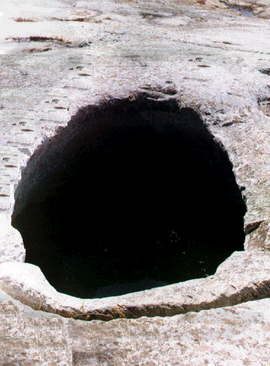
Bell shaped reservoirs built in such a manner allowing rainwater to be collected, channeled and stored with the minimal of losses. Their mouths covered with large stone blocks helping to reduce evaporation from the suns hot rays and providing protection to its user. Presently most of the stone covers are missing, presumably dumped into the wells themselves, however those remaining are clear examples of the workers skill and ingenuity in allowing easy access to the well whilst offering security to the person drawing water from the well.
The first well that one comes across on reaching the site is shallow and barely reaches a depth in access of one meter. Its bottom consist of fragmented stone chippings mixed with mud and silt. It could easily be said that the actuall depth of this well would only be known after further archeological interventions.
The second well is epilictal at the surface, measuring 3.4 meters long and 1.5 meters wide. It is uncovered and of considerable depth, still capable to hold stored water.
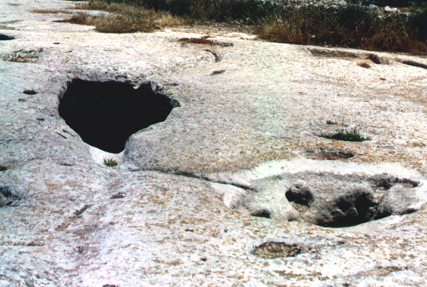
A few meters away from this reservoir, one can find a set of a further three wells dug adjacent to each other and having different characteristics. The well situated the lowest of this “Trio” is the most spectacular of the three due to its grandeur, having a large epilitical mouth measuring 3.3 meters long and 1.2 meters wide. The well is uncovered and connected on either side to two depressions in the limestone surface helping in the collection of rainwater through hand cut channels.
The fourth well has a circular mouth with a diameter of 2.2 meters, and is covered with three longitudinal and three smaller latitudinal stone blocks, with the smaller latitudinal blocks resting at right angles to the others. The smaller blocks fashioned with a guide at each end, allow the user to uncover the well with minimal effort offering access to the water and security to the unwary. This well still holds water
The fifth well also has an elliptical mouth measuring 2.3 meters long and 1.5 meters wide. It was reported to have been covered with four stone blocks of 1.8 meters in length, but presently only one of these blocks remains in situ. Looking into the mouth of this well, one can see the sunrays beneath the waterline emerging from the neighboring well just a few meters away. These two wells are also connected to third well by means of a fissure in its walls, thus maintaining an identical water level in all the three wells.
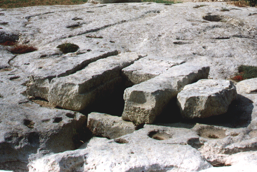
To the north of these wells one can find three additional wells These wells, full of lose rubble and empty from any water are interconnected to each other by means of a large gap in the adjoining wall. Though similar in their construction all have different mouths.
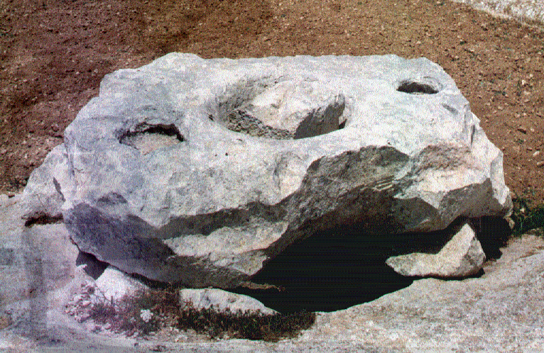
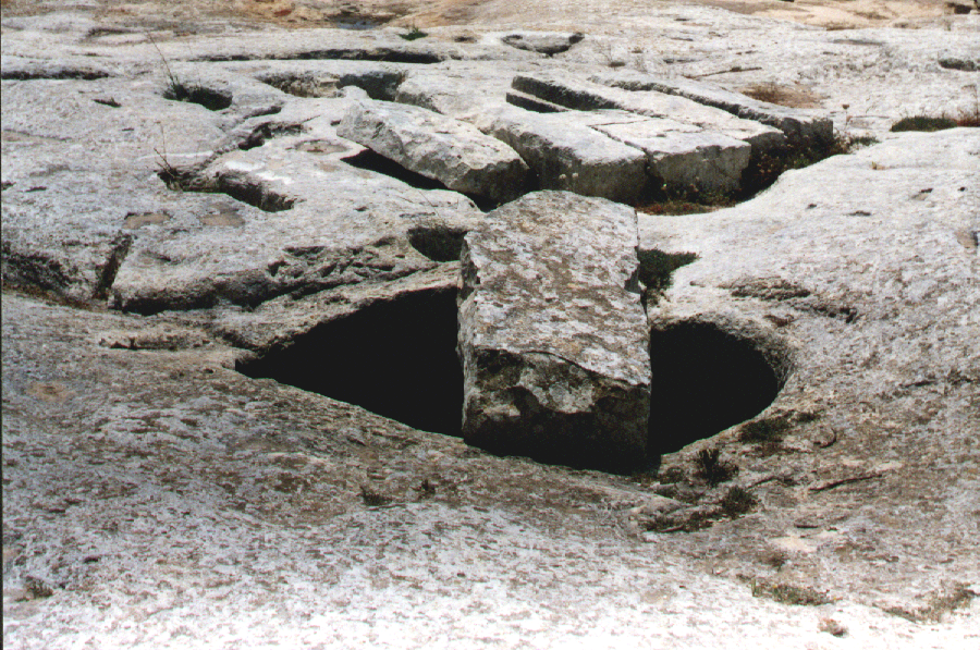
One of these wells, the sixth, has a circular mouth measuring 1.2 meters in diameter, which is covered by a solitary stone block larger than those found in the other receivers. This stone block has a circular hole cut out of its center from which water could be drawn out. This hole is plugged by means of a cone shaped wedge that has got it tightly lodged denying access to the water. Seeking an alternative, this stone block has had one of its sides chiseled. On either side of this hole two small 15 cm. basins are also cut out which could have served the purpose of watering holes for animals.
The seventh well has no stone cover and is empty of any water but full of lose rubble. This well boasts of an intriguing network of rock cut channels used for water catchment purposes.
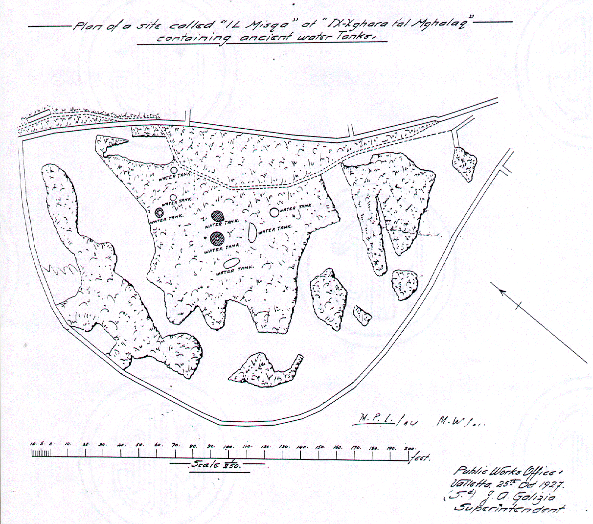
It is believed that a mature fig tree found a few meters to the north of the rest of these wells is growing in the eighth of these wells, at a place in the ground that offered soil humidity all the year around. This site was clearly indicated in a site plan of the area dated 25th October 1927, as produced by Mr. J.A. Galizia Superintendent of the Public Works Office.
The rough chiseling of the rock inside the wells and the large stone covers are clear indication that these are the work of the earliest civilization, possible Neolithic man. The tanks cut with such attention and study of the geological rock formation must have surely been utilized to keep the temple builders supplied with a much-needed supply of precious water. Should this theory be proven, than one can clearly state that these tanks could have been dug between the years 3600 and 1500 B.C?